Lanes launches drone for rail structure inspection
Lanes Group has carried out the first survey of a London Underground building using an aerial drone.
The drainage and maintenance specialist’s rail division carried out the project at the Neasden Lifting Shed in west London.
It teamed up with unmanned aerial systems company Unmanned Aerial Technology Ltd to carry out the drone survey, heralding a “new era” in rail infrastructure inspection, whether carried out during construction or for maintenance.
The approach delivers significant benefits compared with conventional survey techniques, says Lanes Rail Division Commercial Director Matthew Todd.
He added: “Carrying out surveys using pilotless drones results in less impact on the survey site, can deliver significant cost savings, and generates richer survey data which has far more long-term uses in terms of effective maintenance of assets.
“It is an impressive solution for what can be a very difficult tasks, with large, complex and hard-to-access structures. We are already looking at new and advanced ways to use the technology to inspect and survey rail assets.
“Using drones to carry out aerial surveys on rail assets is particularly beneficial, because gaining access to trackside areas is a key issue due to health and safety issues and associated controls.”
Dominic Turner, of Unmanned Aerial Technology Ltd, said: “We are extremely happy to support Lanes Group develop what is a new era of building and structure inspection.
“We’re furthering safety for the rail industry and providing more powerful inspection data, improving the maintenance and development of structures, while reducing inspection time, and downtime rail infrastructure.”
Lanes Rail Division first worked with Unmanned Aerial Technology Ltd, based in Axminster, Devon, on a test flight over a bridge carrying the Piccadilly Line across the River Brent in West London.
London Underground then commissioned Lanes to carry out the drone survey at Neasden Lifting Shed, which is 272-metre-long, and has 844 individual panes of glass.
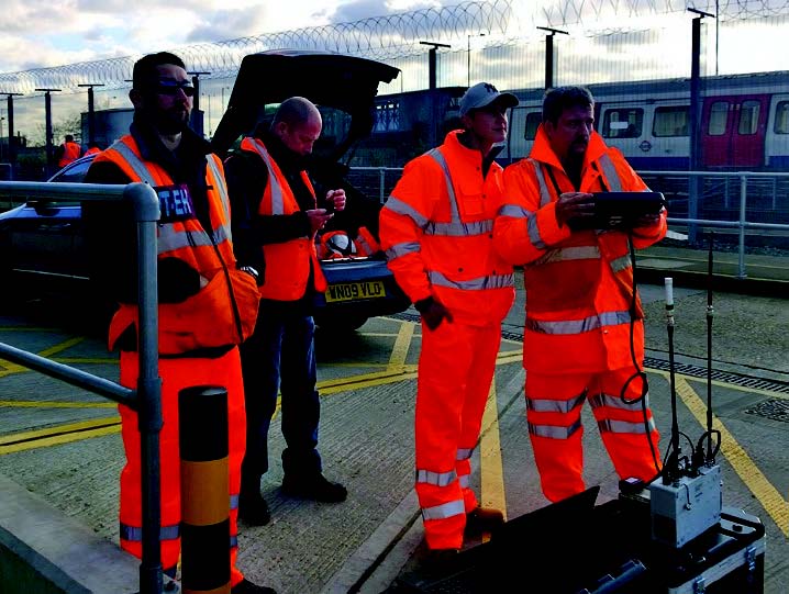
Unmanned Aerial Technology Ltd supplied the drone, imaging equipment and drone pilot, needed to carry out the aerial survey.
A specialist camera on the drone took 184 high definition images of the roof structure. These could then be manipulated in a number of ways to help engineers view and analyse the structure and condition of the roof.
This included stitching all the images together to create a single digital image of the entire roof. A three dimensional point cloud image was also created so the roof could be viewed and measured from any angle.
The images and data were sent by Lanes to engineering consultants, who carried out the analysis and prepared a dilapidation survey report.
Matthew Todd said: “Experienced engineers view the images and can precisely mark and measure points of interest, including where repairs might be required.
“In the future, another drone survey can be done, and the image software will be able to detect differences, which might indicate structural deterioration. This will speed up the process of re-assessing the roof’s condition.”
Matthew Todd said that for complex rail structures, such as bridges and viaducts, using drones to carry out surveys will result in significant cost savings, because structures such as scaffolding will not be required.
He added: “This approach represents a major step forward. Some parts of older rail buildings, going back to the Victorian era are almost impossible to reach, so very difficult to assess, and maintain. That’s not the case any longer.”